 Géo2France
PLAN IGN
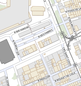
Plan IGN est un ensemble de cartes numériques raster (format image) couvrant l’ensemble des départements français. Plan IGN est un fonds cartographique IGN complet pensé entièrement pour un usage écran. Il est constitué de 19 niveaux de zoom qui cartographient avec précision et lisibilité la France de l’échelle monde au 1 : 1000 environ tout en proposant un contenu cartographique riche à grande échelle, notamment en zone urbaine.
default-legacy
- Date (Revision)
- 2021-12-13
- Citation identifier
- https://www.geo2france.fr/---theme-de-la-donnee---
- Status
- On going
- Point of contact
-
Organisation name Individual name Electronic mail address Role IGN
Point of contact
- Other constraints
-
Licence Ouverte version 2.0 https://www.etalab.gouv.fr/wp-content/uploads/2017/04/ETALAB-Licence-Ouverte-v2.0.pdf
- Spatial representation type
- Grid
- Language
-
fre
- Character set
- UTF8
- Description
-
Hauts-de-France (Région)
))
- OnLine resource
-
Protocol Linkage Name WWW:DOWNLOAD-1.0-http--download
https://geoservices.ign.fr/sites/default/files/2021-07/DC_Plan_IGN.pdf Description détaillée de la donnée Plan IGN
OGC:WMS
https://wxs.ign.fr/cartes/geoportail/r/wms? GEOGRAPHICALGRIDSYSTEMS.PLANIGNV2
OGC:WMTS https://wxs.ign.fr/cartes/geoportail/wmts? GEOGRAPHICALGRIDSYSTEMS.PLANIGNV2
- Hierarchy level
- Dataset
Conformance result
- Date (Publication)
- 2000-01-01
- Explanation
-
-- Information sur l'évaluation de la conformité (non INSPIRE) --
- Pass
- Statement
-
Pour les niveaux de zoom 8 à 10 : Base cartographique France 1000
Pour les niveaux de zoom 11 et 12 : Base cartographique France 250
Pour les niveaux de zoom 13 : Base cartographique France 100
Pour les niveaux de zoom 14 à 18 : BD TOPO
Pour les niveaux de zoom 19 : BD TOPO et Parcellaire express
Metadata
- File identifier
- 09079ac3-5590-4008-b71e-6a9ee8df164f XML
- Metadata language
- Français
- Character set
- UTF8
- Hierarchy level
- Dataset
- Hierarchy level name
-
Précision sur le niveau de hiérarchie (non INSPIRE)
- Date stamp
- 2023-02-06T17:56:57.20177Z
- Metadata standard name
-
ISO 19115:2003/19139
- Metadata standard version
-
1.0
- Metadata author
-
Organisation name Individual name Electronic mail address Role Géo2France
contact@geo2france.fr
Point of contact
Overviews
Spatial extent
Provided by
