 Géo2France
Quartiers de la ville de Saint-Quentin
Découpage administratif en quartier de la ville de Saint-Quentin.
default-legacy
- Date (Creation)
- 2013-12-03
- Date (Publication)
- 2013-12-04
- Date (Revision)
- 2015-02-20
- Citation identifier
- http://saint-quentin-numerique.fr/Quartiers
Point of contact
No information provided.
Point of contact
No information provided.
Point of contact
No information provided.
-
Communes
-
-
SAINT-QUENTIN (02691)
-
- Theme
-
-
contours
-
quartiers
-
découpage
-
-
GEMET - Concepts, version 2.4
-
-
limite administrative
-
zonage
-
- Use limitation
-
Licence Ouverte 1.0 d'octobre 2011 (cf. http://wiki.data.gouv.fr/images/9/9d/Licence_Ouverte.pdf)
- Access constraints
- Other restrictions
- Use constraints
- License
- Other constraints
-
Pas de restriction d’accès public
- Denominator
- 5000
- Language
-
fre
- Character set
- UTF8
- Topic category
-
- Society
- Description
-
SAINT-QUENTIN (02691)
N
S
E
W
))
- Reference system identifier
- EPSG / RGF93 / Lambert-93 (EPSG:2154) / 7.9
- OnLine resource
- Hierarchy level
- Dataset
- Statement
-
Données produites par la Ville de Saint-Quentin
Metadata
- File identifier
- 196e8f7a-acbf-49f1-ba67-e3234a458f6d XML
- Metadata language
- Français
- Character set
- UTF8
- Hierarchy level
- Dataset
- Date stamp
- 2019-06-26T14:35:10
- Metadata standard name
-
ISO 19115:2003/19139
- Metadata standard version
-
1.0
Metadata author
No information provided.
Overviews
thumbnail
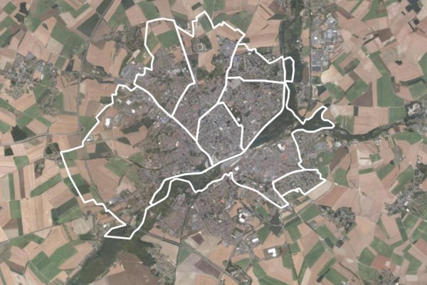
large_thumbnail
Spatial extent
N
S
E
W
Provided by

Associated resources
Not available