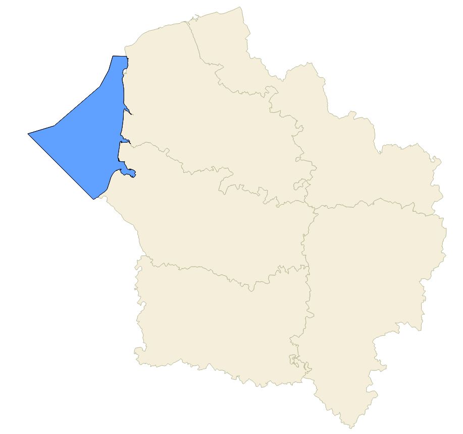
Parc naturel marin des estuaires picards et de la mer d'Opale (2014) - SRADDET Hauts-de-France 2020
Localisation du parc naturel marin (selon les données gouvernementales de 2014). C'est une zone marine protégée ; outil de protection pour la biodiversité et pour les activités humaines dans les estuaires picards et de la mer d'Opale.
Décret n° 2012-1389 du 11 décembre 2012 portant création du parc naturel marin des estuaires picards et de la mer d’Opale
Plus d'informations sur : https://inpn.mnhn.fr/espace/protege/FR9100005
Cette donnée est la représentation figée à la date de vote du SRADDET (approuvé par arrêté préfectoral le 4 août 2020)
default-legacy
- Date (Creation)
- 2020-10-27
- Date (Revision)
- 2021-01-14
- Citation identifier
- fr-200053742/2020/sraddet/cer_reservoir_s_fr32/
- Status
- Completed
- Point of contact
-
Organisation name Individual name Electronic mail address Role Région Hauts-de-France
Point of contact
- Maintenance and update frequency
- As needed
- Keywords
-
-
SRADDET
-
ESTUAIRE
-
AMENAGEMENT DU TERRITOIRE
-
PARC NATUREL MARIN
-
BIODIVERSITE
-
SCHEMA REGIONAL D'AMENAGEMENT DE DEVELOPPEMENT DURABLE ET D'EGALITE DES TERRITOIRES
-
COTE D'OPALE
-
MER
-
LITTORAL
-
- Theme
-
-
GEMET - INSPIRE themes, version 1.0
-
-
Unités administratives
-
-
Région
-
-
HAUTS-DE-FRANCE
-
-
Territoires
-
-
AISNE (Département)
-
OISE (Département)
-
SOMME (Département)
-
NORD (Département)
-
PAS DE CALAIS (Département)
-
-
Thématiques région
-
-
AMENAGEMENT
-
- Use limitation
-
Utilisation libre sous réserve de mentionner la source (a minima le nom du producteur) et la date de sa dernière mise à jour
- Use limitation
-
Données ouvertes
- Access constraints
- Other restrictions
- Use constraints
- Other restrictions
- Denominator
- 25000
Spatial resolution
- Language
-
fre
- Character set
- UTF8
- Topic category
-
- Boundaries
))
- Distribution format
-
Name Version
- Distributor contact
-
Organisation name Individual name Electronic mail address Role Conseil régional Hauts-de-France
Point of contact
- OnLine resource
-
Protocol Linkage Name OGC:WMS
https://qgisserver.hautsdefrance.fr/cgi-bin/qgis_mapserv.fcgi?MAP=/var/www/data/qgis/applications/sraddet_2020_08.qgz cer_parc_naturel_marin
OGC:WFS
https://qgisserver.hautsdefrance.fr/cgi-bin/qgis_mapserv.fcgi?MAP=/var/www/data/qgis/applications/sraddet_2020_08.qgz cer_parc_naturel_marin
- Hierarchy level
- Dataset
Conformance result
- Title
-
-- Titre d'une spécification à laquelle la série de données est conforme ou non --
- Date (Publication)
- 2000-01-01
- Explanation
-
-- Information sur l'évaluation de la conformité (non INSPIRE) --
- Pass
- Statement
-
Source : INPN (Inventaire national du patrimoine naturel)
Flux WFS utilisé pour cette donnée http://ws.carmencarto.fr/WFS/119/fxx_inpn?
Donnée figée à la date de vote du SRADDET (approuvé par arrêté préfectoral le 4 août 2020)
Metadata
- File identifier
- 5b498ac5-0aeb-4d31-99cb-f4788baf63d3 XML
- Metadata language
- Français
- Character set
- UTF8
- Hierarchy level
- Dataset
- Hierarchy level name
-
Précision sur le niveau de hiérarchie (non INSPIRE)
- Date stamp
- 2026-03-20T15:20:59.85513Z
- Metadata standard name
-
ISO 19115:2003/19139
- Metadata standard version
-
1.0
- Metadata author
-
Organisation name Individual name Electronic mail address Role Région Hauts-de-France
Point of contact
)))