 Géo2France
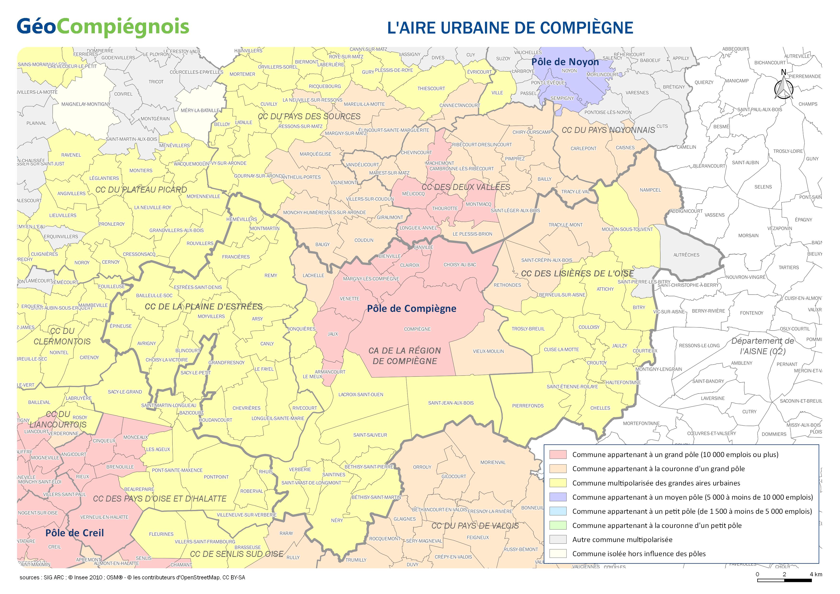
L'aire urbaine de Compiègne
Carte délimitant l'aire urbaine de Compiègne. Donnée issue de l'Insee publiée en 2010.
default-legacy
- Date (Publication)
- 2017-01-03T09:00:00
- Presentation form
- Digital map
Point of contact
No information provided.
-
GEMET - INSPIRE themes, version 1.0 INSPIRE themes
-
-
Unités statistiques
-
-
GEMET - Concepts, version 2.4
-
-
carte
-
-
Collectivités du Pays Compiégnois
-
-
Pays-Compiégnois
-
- Use constraints
- Copyright
- Use limitation
-
Utilisation libre sous réserve de mentionner la source (a minima le nom du producteur) et la date de sa dernière mise à jour
- Denominator
- 200000
- Language
- Français
- Topic category
-
- Boundaries
- Description
-
Pays-Compiégnois
N
S
E
W
))
- Reference system identifier
- EPSG / RGF93 / Lambert-93 (EPSG:2154) / 7.9
- Distribution format
-
Name Version JPEG
{{format_version}}
- OnLine resource
-
Protocol Linkage Name WWW:LINK-1.0-http--link
http://geo.compiegnois.fr/documents/cartotheque/APC_aire_urbaine.jpg APC_aire_urbaine
Metadata
- File identifier
- 5c43ea42-2ebe-4a9f-9306-ac536faa936e XML
- Metadata language
- Français
- Character set
- UTF8
- Hierarchy level
- Dataset
- Date stamp
- 2017-01-03T14:45:17
- Metadata standard name
-
ISO 19115:2003/19139
- Metadata standard version
-
1.0
Metadata author
No information provided.
Overviews
Spatial extent
N
S
E
W
Provided by

Associated resources
Not available