
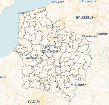
EPCI de la Région Hauts-de-France
Limites des EPCI (établissement public de coopération intercommunale) à fiscalité propre de la région Hauts-de-France.
Dernière donnée disponible (janvier 2025)
Précisions
- La CC Coeur d'Ostrevent (2024) devient CA Coeur d'Ostrevent (202) et conserve le code 245901152.
- La CC Flandre intérieure (2023) devient CA Coeur de Flandre (2024) et conserve le code 200040947
- La commune d’Emerchicourt (59192) revient à la CA de la Porte du Hainaut
default-legacy
- Date (Revision)
- 2025-02-06
- Citation identifier
- fr-200053742/2019/limite/epci
- Point of contact
-
Organisation name Individual name Electronic mail address Role Géo2France
Géo2France
Point of contact
- Maintenance and update frequency
- As needed
- Theme
-
-
UNITE ADMINISTRATIVE
-
EPCI
-
COMMUNE
-
REGROUPEMENT
-
COOPERATION INTERCOMMUNALE
-
LIMITE ADMINISTRATIVE
-
DONNEE OUVERTE
-
SPRD
-
-
Thèmes - SIG - HdF
-
-
AMENAGEMENT
-
-
Départements
-
-
SOMME
-
NORD
-
AISNE
-
OISE
-
PAS-DE-CALAIS
-
- Use limitation
-
Utilisation libre sous réserve de mentionner la source (a minima le nom du producteur) et la date de sa dernière mise à jour
- Use limitation
-
Données ouvertes
- Use constraints
- Other restrictions
- Denominator
- 5000
Spatial resolution
- Language
-
fre
- Character set
- UTF8
- Topic category
-
- Boundaries
))
- Distribution format
-
Name Version
- Distributor contact
-
Organisation name Individual name Electronic mail address Role Conseil régional Hauts-de-France
Point of contact
- OnLine resource
-
Protocol Linkage Name WWW:LINK-1.0-http--link
https://geoterritoires.hautsdefrance.fr/#c=indicator&view=map35 Datavisualisation de la donnée
https://www.geo2france.fr/geoserver/spld/ows spld:epci
OGC:WMS
https://www.geo2france.fr/geoserver/spld/ows epci
OGC:WMS
https://www.geo2france.fr/geoserver/spld/ows epci_hdf_com
- Hierarchy level
- Dataset
Conformance result
- Title
-
INSPIRE Data Specification on Administrative Units - Guidelines v3.0.1
- Date (Publication)
- 2000-01-01
- Explanation
-
-- Information sur l'évaluation de la conformité (non INSPIRE) --
- Pass
- Statement
-
Les établissements publics de coopération intercommunale (EPCI) sont des regroupements de communes se basant sur la liste des communes donnée par le Code officiel géographique (COG).
La source géométrique est la BD Topo IGN de décembre 2023, et la source de la population est l’INSEE, RP 2021
Actualisation janvier 2025
Metadata
- File identifier
- 791b9687-7b77-4db1-a78e-61a517668c3b XML
- Metadata language
- Français
- Character set
- UTF8
- Hierarchy level
- Dataset
- Hierarchy level name
-
Précision sur le niveau de hiérarchie (non INSPIRE)
- Date stamp
- 2025-10-03T14:24:23.659105Z
- Metadata standard name
-
ISO 19115:2003/19139
- Metadata standard version
-
1.0
- Metadata author
-
Organisation name Individual name Electronic mail address Role Géo2France
Géo2France
Author
)))