
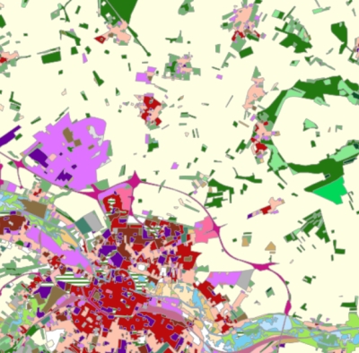
Occupation du sol Hauts-de-France (2009-2010)
Occupation du sol construite par fusion des bases de données de GéoPicardie et du Nord Pas de Calais et par l'application d'une nomenclature commune.
default-legacy
- Date (Creation)
- 2017-01-31
- Citation identifier
- http://www.hautsdefrance.fr/data/hdf-mos-2010
Point of contact
- Keywords
-
-
OCS
-
MOS
-
donnée ouverte
-
licence ouverte
-
- Use limitation
-
Licence Ouverte - http://www.etalab.gouv.fr/licence-ouverte-open-licence
- Access constraints
- License
- Use constraints
- License
- Other constraints
-
Pas de restriction d’accès public
- Use limitation
-
Données ouvertes
- Denominator
- 12000
- Language
-
fre
- Character set
- UTF8
- Topic category
-
- Imagery base maps earth cover
- Description
-
France
))
Digital transfer options
- OnLine resource
-
Protocol Linkage Name OGC:WMS
https://www.geo2france.fr/geoserver/hdf_common/ows?service=WMS&request=GetCapabilities ocs_hdf_2009_2010
OGC:WFS
https://www.geo2france.fr/geoserver/hdf_common/ows?service=WFS&request=GetCapabilities hdf_common:ocs_hdf_2009_2010
WWW:DOWNLOAD-1.0-http--download https://www.geo2france.fr/public/nomenclature_ocs_hdf_2009_2010.ods Nomenclature
- Hierarchy level
- Dataset
Conformance result
- Title
-
COMMISSION REGULATION (EU) No 1089/2010 of 23 November 2010 implementing Directive 2007/2/EC of the European Parliament and of the Council as regards interoperability of spatial data sets and services
- Date (Publication)
- 2000-01-01
- Explanation
-
Aucune action de vérification de la conformité n'a été réalisée
- Pass
- No
- Statement
-
Occupation du sol construite par fusion des bases de données de GéoPicardie et du Nord Pas de Calais et par l'application d'une nomenclature commune.
Metadata
- File identifier
- 7fac6bc0-9db8-4247-993c-ba2404387bbf XML
- Metadata language
- Français
- Character set
- UTF8
- Hierarchy level
- Dataset
- Hierarchy level name
-
Précision sur le niveau de hiérarchie (non INSPIRE)
- Date stamp
- 2026-07-27T09:10:34.248483Z
- Metadata standard name
-
ISO 19115:2003/19139
- Metadata standard version
-
1.0
)))