 Géo2France
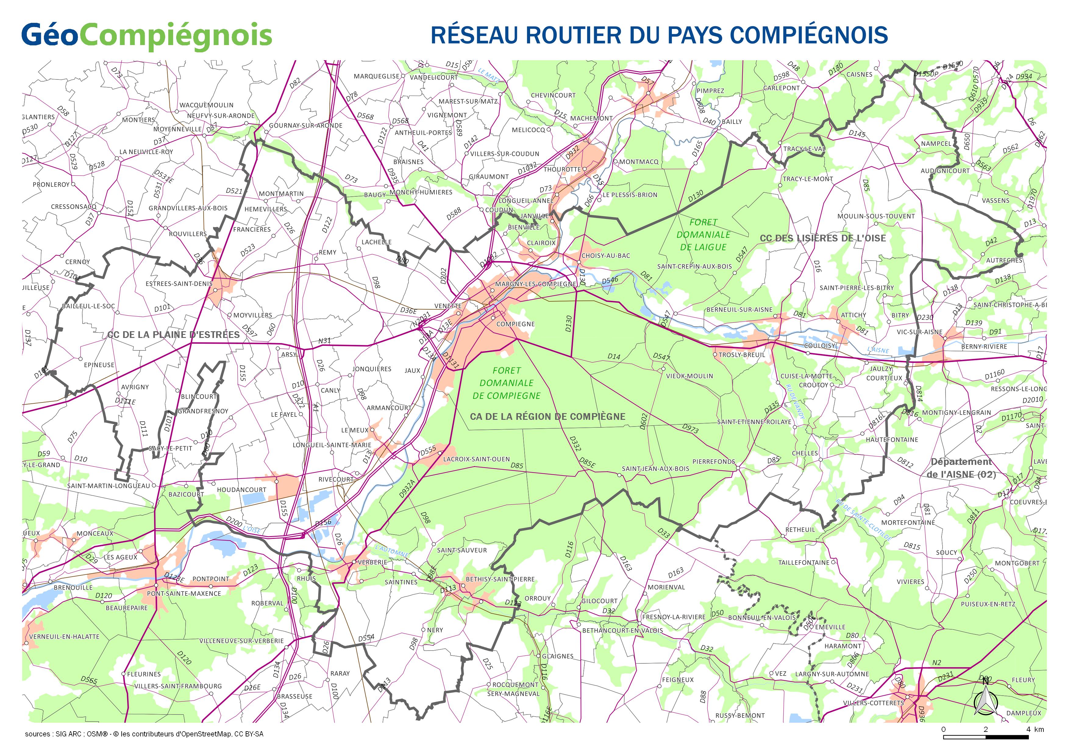
Réseau routier du Pays Compiégnois
Carte sur les principaux axes routiers du Pays Compiégnois.
default-legacy
- Date (Publication)
- 2018-01-09T09:00:00
- Presentation form
- Digital map
- Point of contact
-
Organisation name Individual name Electronic mail address Role GéoCompiégnois
sig@agglo-compiegne.fr
Author
-
GEMET - INSPIRE themes, version 1.0
-
-
Réseaux de transport
-
-
Collectivités du Pays Compiégnois
-
-
Pays-Compiégnois
-
- Use constraints
- Copyright
- Use limitation
-
Utilisation libre sous réserve de mentionner la source (a minima le nom du producteur) et la date de sa dernière mise à jour
- Denominator
- 200000
- Language
- Français
- Topic category
-
- Transportation
- Description
-
Pays-Compiégnois
N
S
E
W
))
- Reference system identifier
- EPSG / RGF93 / Lambert-93 (EPSG:2154) / 7.9
- Distribution format
-
Name Version JPEG
- OnLine resource
-
Protocol Linkage Name WWW:LINK-1.0-http--link
http://geo.compiegnois.fr/documents/cartotheque/APC_carte_routiere.jpg Réseau routier du Pays Compiégnois
Conformance result
- Date (Publication)
Metadata
- File identifier
- 856c3e68-7da1-466b-b4fe-a6b8a6e56671 XML
- Metadata language
- Français
- Character set
- UTF8
- Hierarchy level
- Dataset
- Date stamp
- 2018-01-09T10:43:31
- Metadata standard name
-
ISO 19115:2003/19139
- Metadata standard version
-
1.0
- Metadata author
-
Organisation name Individual name Electronic mail address Role GéoCompiégnois
sig@agglo-compiegne.fr
Point of contact
Overviews
Spatial extent
N
S
E
W
Provided by

Associated resources
Not available