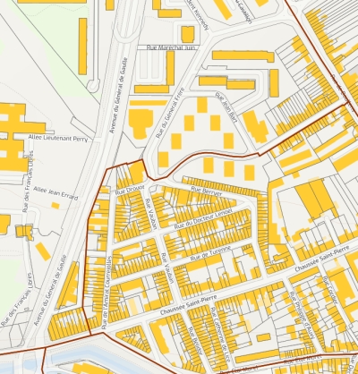
Cadastre - PCI vecteur
Plan cadastral de la région Hauts-de-France - millésime 2023
default-legacy
- Date (Publication)
- 2018-01-01
- Citation identifier
- https://www.ge2france.fr/pci_vecteur
- Point of contact
-
Organisation name Individual name Electronic mail address Role Géo2France
Resource provider
-
Région
-
-
HAUTS-DE-FRANCE
-
-
Départements
-
-
AISNE
-
OISE
-
PAS-DE-CALAIS
-
NORD
-
SOMME
-
- Theme
-
-
CADASTRE
-
PCI
-
VECTEUR
-
DONNEE OUVERTE
-
SPRD
-
- Use limitation
-
Aucune condition ne s’applique
- Other constraints
-
Indiquer la source (DGFiP) et le millésime (2023)
- Distance
- 5 m
- Denominator
- 1500
- Language
-
fre
- Character set
- UTF8
- Topic category
-
- Planning cadastre
- Description
-
France
- Description
-
HAUTS-DE-FRANCE
N
S
E
W
))
- OnLine resource
-
Protocol Linkage Name https://www.geo2france.fr/geoserver/pci/ows cadastre
https://www.geo2france.fr/geoserver/pci/ows pci:geo_parcelle_2023
https://www.geo2france.fr/geoserver/pci/ows geo_commune_2023
https://www.geo2france.fr/geoserver/pci/ows geo_batiment_2023
https://www.geo2france.fr/geoserver/pci/ows geo_parcelle_2023
https://www.geo2france.fr/geoserver/pci/ows geo_section_2023
- Hierarchy level
- Dataset
Conformance result
- Date (Publication)
- 2000-01-01
- Explanation
-
-- Information sur l'évaluation de la conformité (non INSPIRE) --
- Pass
- Statement
-
Plan cadastral issu de l'intégration des fichiers EDIGEO téléchargés sur cadastre.data.gouv.fr, des fichiers MAJIC de la DGFiP et traités par le plugin cadastre pour QGIS.
Metadata
- File identifier
- 85981e02-e82a-4b71-961f-29bdddcc85a1 XML
- Metadata language
- Français
- Character set
- UTF8
- Hierarchy level
- Dataset
- Hierarchy level name
-
Précision sur le niveau de hiérarchie (non INSPIRE)
- Date stamp
- 2024-08-01T09:34:55.224162Z
- Metadata standard name
-
ISO 19115:2003/19139
- Metadata standard version
-
1.0
- Metadata author
-
Organisation name Individual name Electronic mail address Role Géo2France
Point of contact
Overviews

Spatial extent
N
S
E
W
))
Provided by

Associated resources
Not available