Atlas des punaises de Picardie
Atlas des punaises (Heteroptera) réalisé par Picardie Nature
default-legacy
- Date (Creation)
- 2022-05-17
- Citation identifier
- cbeee78e-daf0-44e5-99bc-a4d2b36ad9c4
- Status
- On going
- Point of contact
-
Organisation name Individual name Electronic mail address Role Picardie Nature
Point of contact Picardie Nature
Author
- Keywords
-
-
faune
-
DONNEE OUVERTE
-
biodiversité
-
entomologie
-
- Use limitation
-
Donnée ouverte
- Access constraints
- Other restrictions
- Distance
- 1 m
- Denominator
- 5000
- Language
-
fre
- Character set
- UTF8
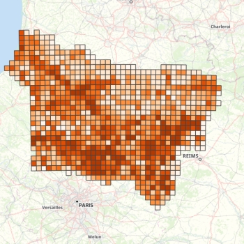
- Description
-
Picardie
N
S
E
W
))
- Distribution format
-
Name Version
- OnLine resource
-
Protocol Linkage Name OGC:WMS
https://www.geo2france.fr:443/geoserver/picardie_nature/ows atlas_punaises
OGC:WFS
https://www.geo2france.fr:443/geoserver/picardie_nature/ows picardie_nature:atlas_punaises
WWW:LINK-1.0-http--related
https://oursin.clicnat.fr/?x=326292&y=6407945&z=8&l=atlas_punaises*&lb=osm_naturaliste&mode=d Clicnat-OURSIN
- Hierarchy level
- Dataset
Conformance result
- Date (Publication)
- 2000-01-01
- Explanation
-
-- Information sur l'évaluation de la conformité (non INSPIRE) --
- Pass
- Statement
-
Synthèse d'observations de terrain
Metadata
- File identifier
- cbeee78e-daf0-44e5-99bc-a4d2b36ad9c4 XML
- Metadata language
- Français
- Character set
- UTF8
- Hierarchy level
- Dataset
- Hierarchy level name
-
Précision sur le niveau de hiérarchie (non INSPIRE)
- Date stamp
- 2024-08-01T09:52:14.289544Z
- Metadata standard name
-
ISO 19115:2003/19139
- Metadata standard version
-
1.0
- Metadata author
-
Organisation name Individual name Electronic mail address Role Picardie Nature
Author
Overviews

Spatial extent
N
S
E
W
Provided by

Associated resources
Not available