
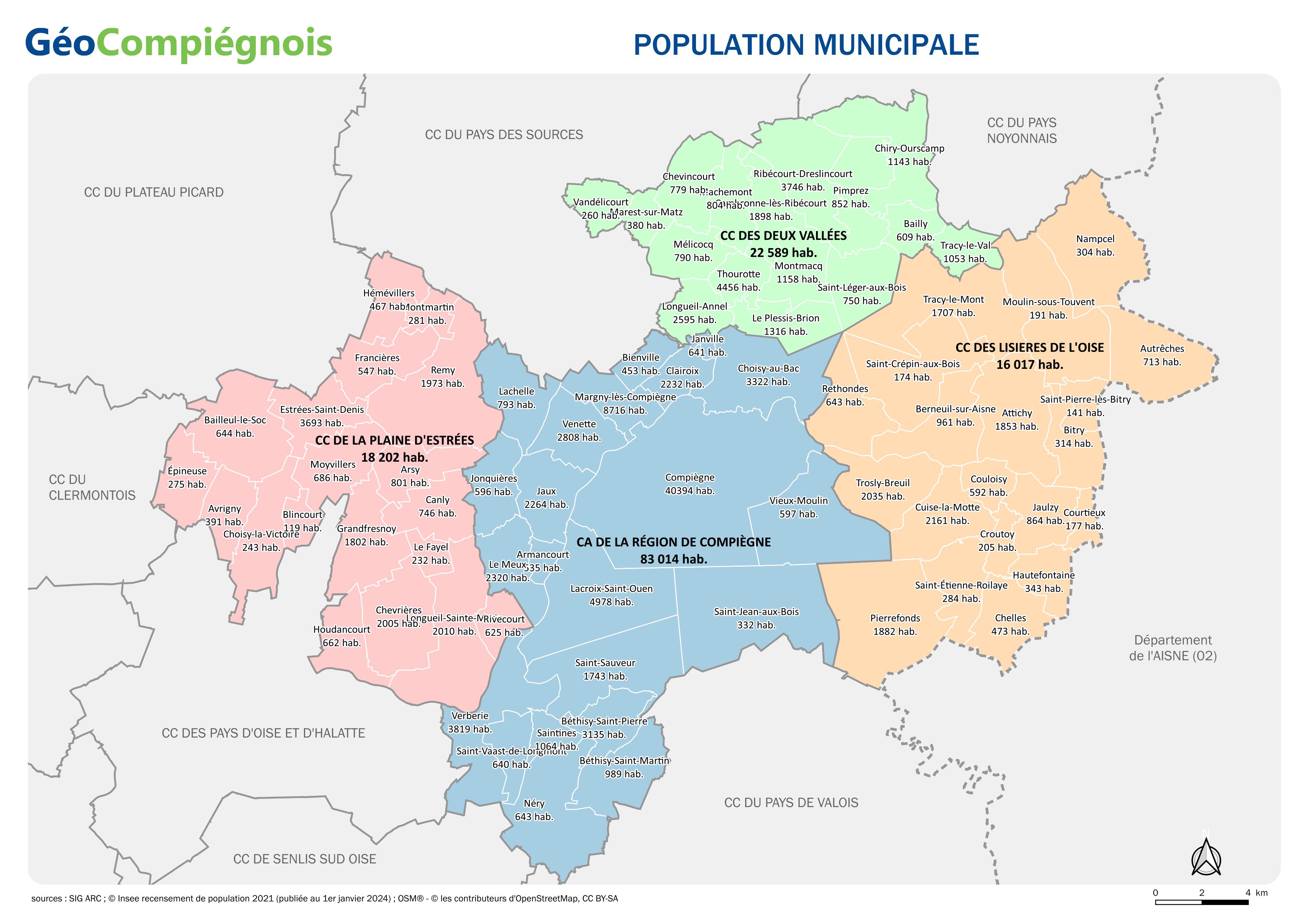
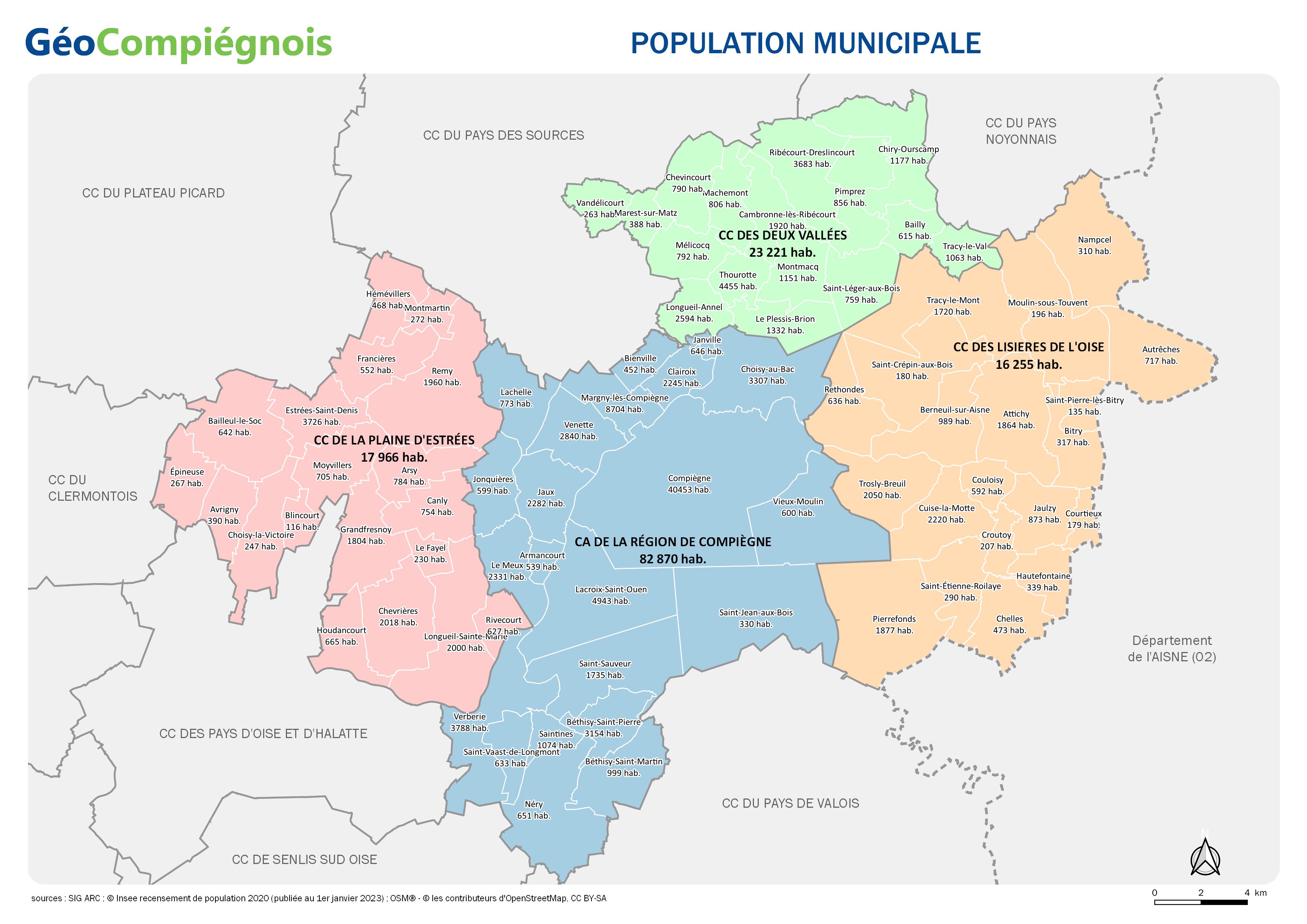
Population des communes du Grand Compiégnois
Carte administrative sur le territoire du Grand Compiégnois avec indication des chiffres de population municipale. Données issues de l'Insee publiées au 1er janvier 2025
default-legacy
- Date (Revision)
- 2025-01-08T09:00:00
- Presentation form
- Digital map
Point of contact
No information provided.
-
GEMET - INSPIRE themes, version 1.0
-
-
Unités statistiques
-
-
GEMET - Concepts, version 2.4
-
-
carte
-
population
-
-
Collectivités du Pays Compiégnois
-
-
Grand-Compiégnois
-
- Use constraints
- Copyright
- Use limitation
-
Utilisation libre sous réserve de mentionner la source (a minima le nom du producteur) et la date de sa dernière mise à jour
- Denominator
- 200000
- Language
- Français
- Topic category
-
- Boundaries
- Description
-
Grand-Compiégnois
N
S
E
W
))
- Codespace
-
EPSG
- Version
-
7.9
- Distribution format
-
Name Version
- OnLine resource
-
Protocol Linkage Name WWW:LINK-1.0-http--link
http://geo.compiegnois.fr/documents/cartotheque/GRDC_carte_chiffres_population.jpg Carte sur la population des communes du Grand Compiégnois
Conformance result
- Date (Publication)
Metadata
- File identifier
- cef214b0-c301-45c4-9220-2c606fcef0e5 XML
- Metadata language
- Français
- Character set
- UTF8
- Hierarchy level
- Map
- Date stamp
- 2025-01-08T10:28:13
- Metadata standard name
-
ISO 19115:2003/19139
- Metadata standard version
-
1.0
Metadata author
No information provided.
Overviews
Spatial extent
N
S
E
W
Provided by

Associated resources
Not available