 Géo2France
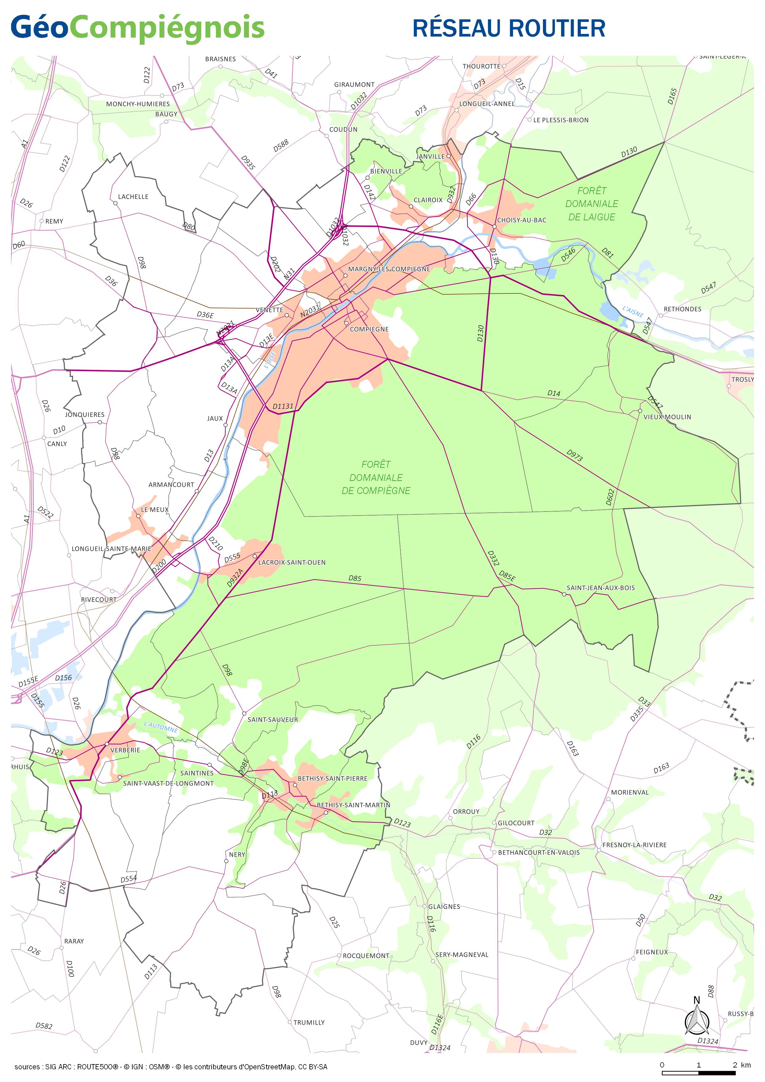
Réseau routier de la CA de la Région de Compiègne
Carte sur les principaux axes routiers de la Communauté d'Agglomération de la Région de Compiègne.
default-legacy
- Date (Publication)
- 2017-01-03T09:00:00
- Presentation form
- Digital map
Point of contact
No information provided.
-
GEMET - INSPIRE themes, version 1.0
-
-
Réseaux de transport
-
-
Collectivités du Pays Compiégnois
-
-
CA-de-la-Région-de-Compiègne*ARC
-
CC-de-la-Basse-Automne*CCBA
-
- Use constraints
- Copyright
- Use limitation
-
Utilisation libre sous réserve de mentionner la source (a minima le nom du producteur) et la date de sa dernière mise à jour
- Denominator
- 200000
- Language
- Français
- Topic category
-
- Transportation
- Description
-
CA-de-la-Région-de-Compiègne*ARC
N
S
E
W
))
- Reference system identifier
- EPSG / RGF93 / Lambert-93 (EPSG:2154) / 7.9
- Distribution format
-
Name Version JPEG
- OnLine resource
-
Protocol Linkage Name WWW:LINK-1.0-http--link
http://geo.compiegnois.fr/documents/cartotheque/ARC_CCBA_carte_routiere.jpg ARC_CCBA_carte_routiere
Conformance result
- Date (Publication)
Metadata
- File identifier
- dabf9631-1689-4b35-be71-b70c1b929546 XML
- Metadata language
- Français
- Character set
- UTF8
- Hierarchy level
- Dataset
- Date stamp
- 2017-02-14T10:13:51
- Metadata standard name
-
ISO 19115:2003/19139
- Metadata standard version
-
1.0
Metadata author
No information provided.
Overviews
thumbnail
Spatial extent
N
S
E
W
Provided by

Associated resources
Not available