
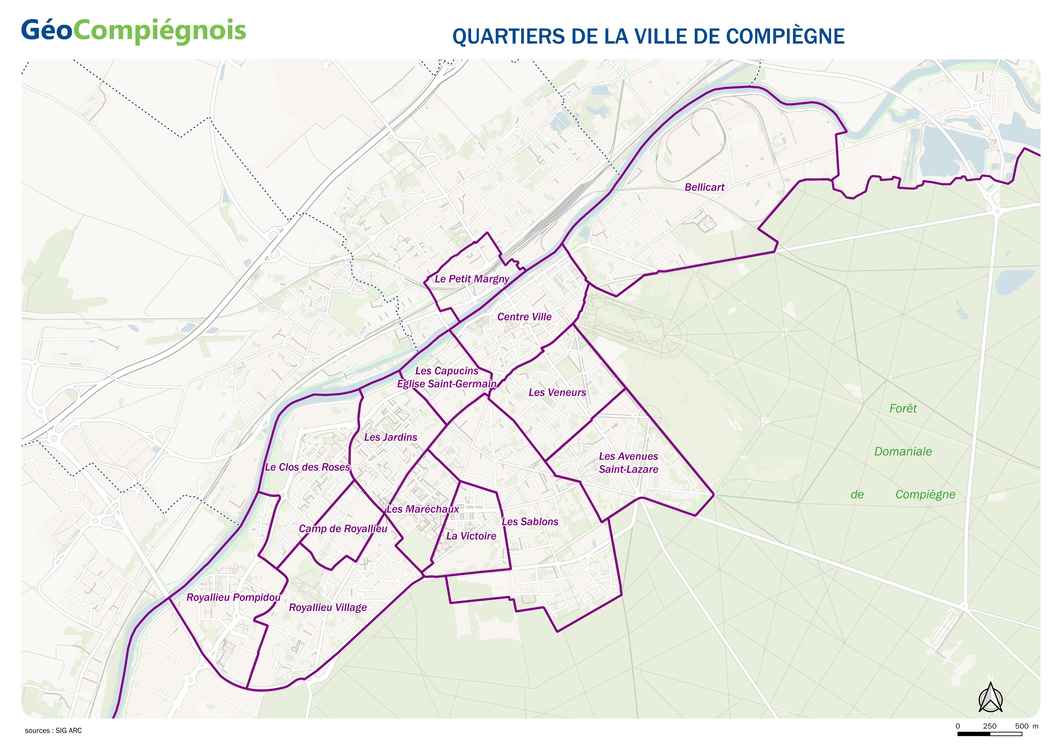
Quartiers de la ville de Compiègne
Découpage officiel des quartiers de la ville de Compiègne.
default-legacy
- Date (Creation)
- 2016-04-08T09:00:00
- Date (Revision)
- 2019-07-11
- Presentation form
- Digital map
Point of contact
No information provided.
-
GEMET - INSPIRE themes, version 1.0
-
-
Unités administratives
-
-
GEMET - Concepts, version 2.4
-
-
limite administrative
-
carte
-
- Theme
-
-
Quartier
-
-
Collectivités du Pays Compiégnois
-
-
Compiègne*60159
-
- Use constraints
- Copyright
- Use limitation
-
Utilisation libre sous réserve de mentionner la source (a minima le nom du producteur) et la date de sa dernière mise à jour
- Denominator
- 25000
- Language
- Français
- Topic category
-
- Boundaries
- Description
-
Compiègne*60159
N
S
E
W
))
- Reference system identifier
- EPSG / RGF93 / Lambert-93 (EPSG:2154) / 7.9
- Distribution format
-
Name Version JPEG
- OnLine resource
-
Protocol Linkage Name WWW:LINK-1.0-http--link
http://geo.compiegnois.fr/documents/cartotheque/COMPIEGNE_quartiers.jpg COMPIEGNE_quartiers
Conformance result
- Date (Publication)
Metadata
- File identifier
- e0089aee-e635-4ae4-b2e4-12cab64f3e5d XML
- Metadata language
- Français
- Character set
- UTF8
- Hierarchy level
- Dataset
- Date stamp
- 2024-04-22T11:03:02
- Metadata standard name
-
ISO 19115:2003/19139
- Metadata standard version
-
1.0
Metadata author
No information provided.
Overviews
Spatial extent
N
S
E
W
Provided by

Associated resources
Not available